The itinerary is designed to:
- allow proper acclimatization,
- avoid exhausting drives,
- cover major attractions,
- and give you the complete Spiti circuit experience.
This route follows the safest and most recommended circuit:
Chandigarh → Shimla → Kinnaur → Kaza → Chandratal → Manali → Chandigarh
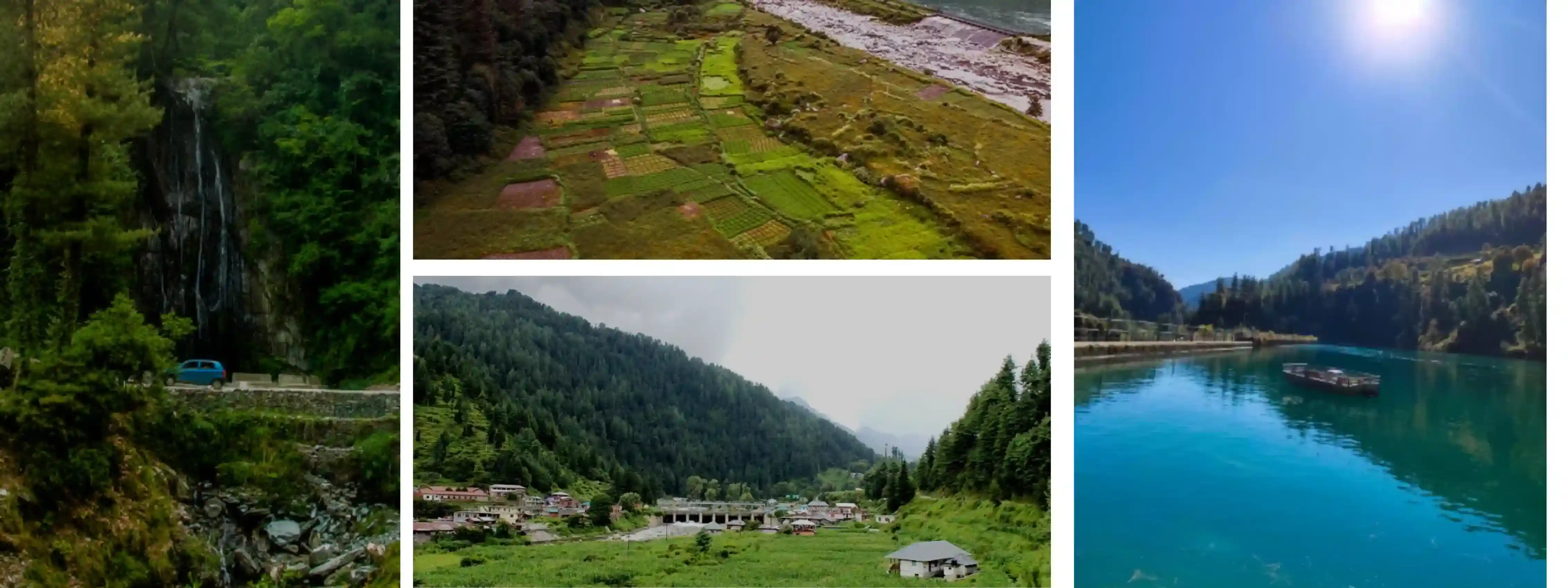
Day 1: Chandigarh to Narkanda
Distance
Approximately:
180–190 km
Driving Time
7–8 hours depending on traffic near Shimla.
Why Stay in Narkanda?
Most travelers make the mistake of directly driving to Sangla on Day 1, which becomes extremely tiring.
Narkanda is a perfect first stop because:
- it breaks the journey comfortably,
- helps gradual acclimatization,
- and offers beautiful mountain views.
Route for Day 1
Chandigarh → Solan → Shimla → Kufri → Narkanda
Road Conditions
Chandigarh to Shimla
- Smooth highway
- Good roads
- Heavy traffic possible near Shimla
Shimla to Narkanda
- Scenic mountain roads
- Mostly well-maintained
- Easy driving conditions
Places to Stop on the Way
Timber Trail
Good breakfast stop near Parwanoo.
Kufri
Quick stop for:
- mountain views,
- cafes,
- and photography.
Theog
Ideal for tea/snack breaks.
Things to Do in Narkanda
If you reach early:
- explore apple orchards,
- enjoy sunset views,
- or visit Hatu Peak.
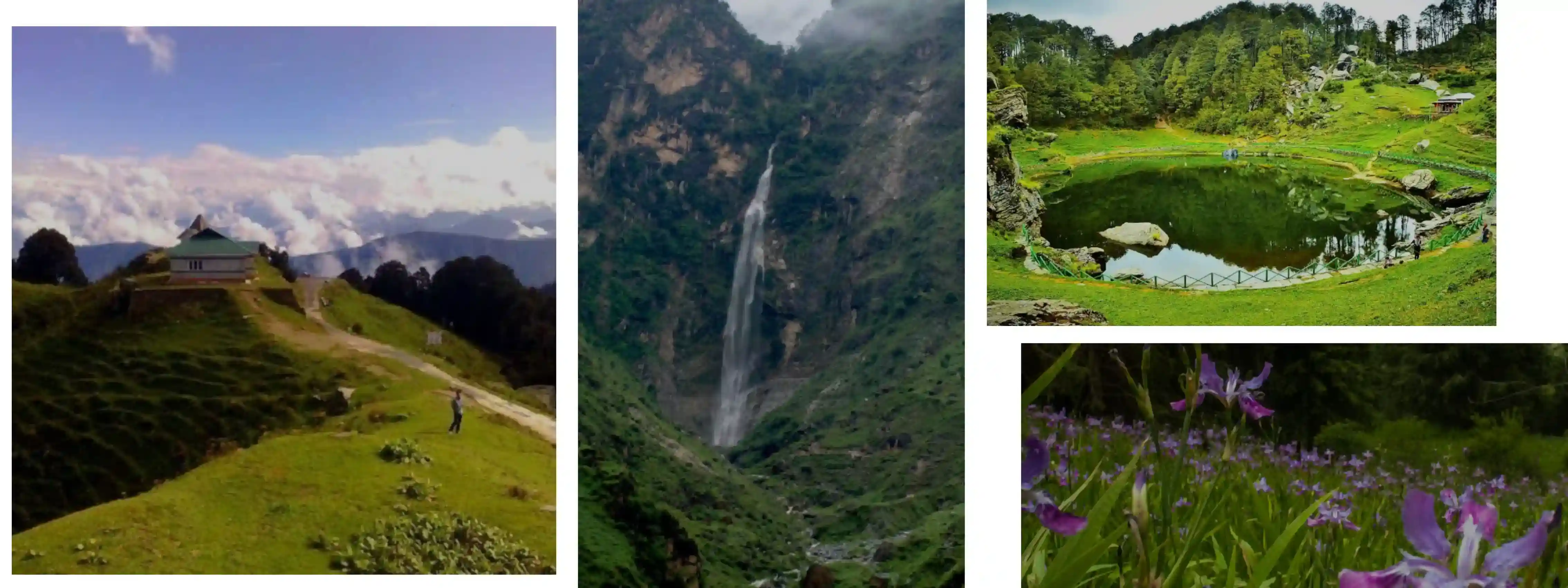
Hatu Peak (Optional)
One of the best viewpoints near Narkanda.
Highlights:
- panoramic Himalayan views,
- pine forests,
- peaceful atmosphere.
Road to Hatu Peak can be narrow but scenic.
Where to Stay in Narkanda
You’ll find:
- hotels,
- cottages,
- and homestays.
Recommended stay type:
Mountain-view hotel or wooden cottage
Approx Hotel Cost
| Stay Type |
Average Cost |
| Budget hotel |
₹1,000–₹2,000 |
| Mid-range stay |
₹2,500–₹5,000 |
| Premium property |
₹6,000+ |
Food Availability
Narkanda has:
- local dhabas,
- cafes,
- and hotels with restaurants.
Try:
- Himachali food,
- rajma rice,
- and local apple products.
Important Tips for Day 1
- ✔ Start early from Chandigarh
- ✔ Avoid Shimla traffic by leaving before sunrise
- ✔ Keep warm clothes accessible
- ✔ Refuel before entering upper mountain regions
- ✔ Don’t overdrive on the first day
Day 2: Narkanda to Sangla / Chitkul
Distance
Approximately:
160–180 km
depending on where you stay.
Driving Time
7–9 hours
Roads become narrower and more adventurous after Rampur.
Why This Day Is Special
This stretch is considered one of the most scenic drives in Himachal Pradesh.
You’ll experience:
- dramatic mountain roads,
- cliffside highways,
- Baspa River views,
- and beautiful Kinnaur landscapes.
Route for Day 2
Narkanda → Rampur → Karcham → Sangla → Chitkul
Road Conditions
Narkanda to Rampur
- Mostly smooth roads
- Beautiful forest views
Rampur to Sangla
Roads become:
- narrower,
- rougher,
- and more adventurous.
Some cliffside sections can feel intense for first-time travelers.
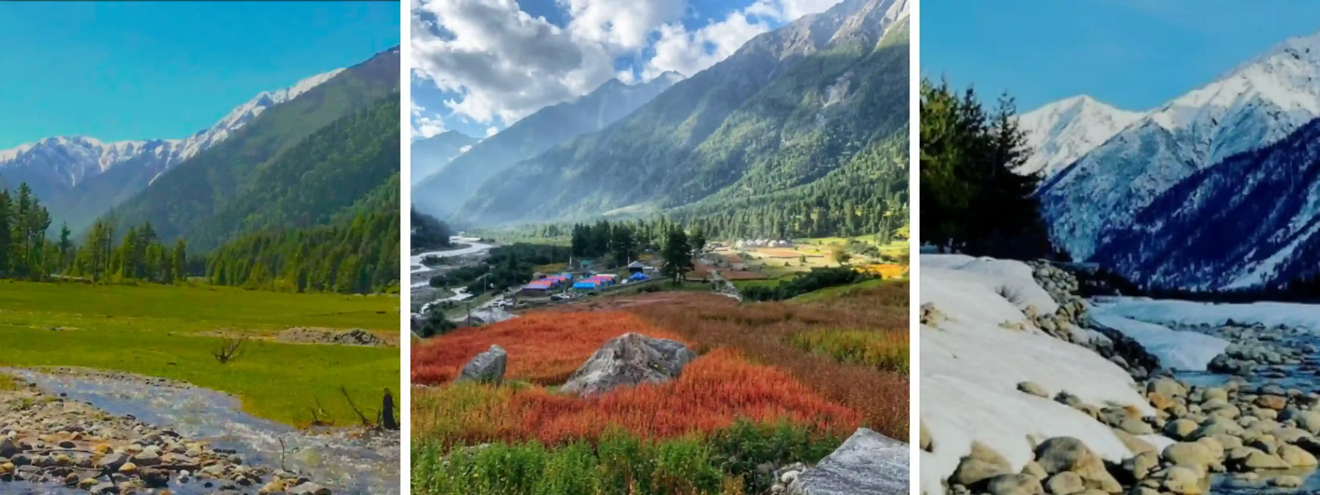
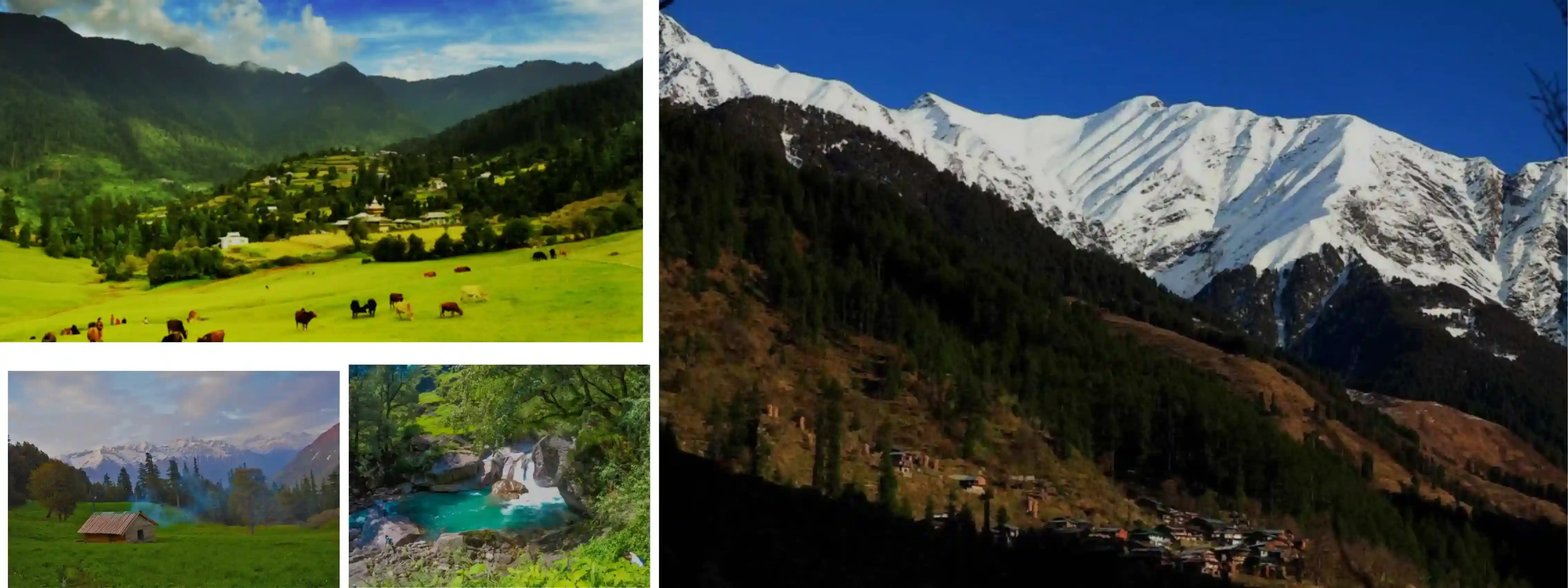
Sangla Valley Highlights
Sangla Valley is famous for:
- lush greenery,
- riverside landscapes,
- apple orchards,
- and traditional wooden houses.
It feels completely different from Spiti’s barren terrain.
Chitkul Village
Last Indian Village Near Indo-Tibet Border
Chitkul is one of the highlights of the entire trip.
Known for:
- wooden homes,
- mountain scenery,
- Baspa River,
- and peaceful atmosphere.
Things to Do in Chitkul
Walk Along Baspa River
One of the most beautiful riverside experiences in Himachal.
Visit Hindustan Ka Aakhri Dhaba
Popular tourist stop near the border road.
Explore Local Village Streets
The village itself feels calm and untouched.
Best Places for Photography
- Baspa River viewpoints
- Wooden bridges
- Snow-covered peaks
- Chitkul village roads
Where to Stay
Option 1: Sangla
Better hotel options and easier accessibility.
Option 2: Chitkul
More scenic and peaceful experience.
Recommended if:
- weather is stable,
- and you want a quieter mountain stay.
Approx Hotel Cost
| Stay Type |
Average Cost |
| Budget homestay |
₹1,200–₹2,000 |
| Mid-range hotel |
₹3,000–₹5,000 |
| Riverside camps |
₹4,000–₹7,000 |
Food Availability
You’ll find:
- cafes,
- dhabas,
- and local restaurants.
Popular items:
- momos,
- thukpa,
- maggi,
- and Himachali meals.
Important Tips for Day 2
- ✔ Start early from Narkanda
- ✔ Roads after Rampur require careful driving
- ✔ Keep snacks and water in the car
- ✔ Mobile networks may weaken in some areas
- ✔ Avoid driving after sunset
Day 3: Sangla / Chitkul to Kalpa or Nako
Distance
140–170 km
depending on stay location.
Driving Time
6–8 hours
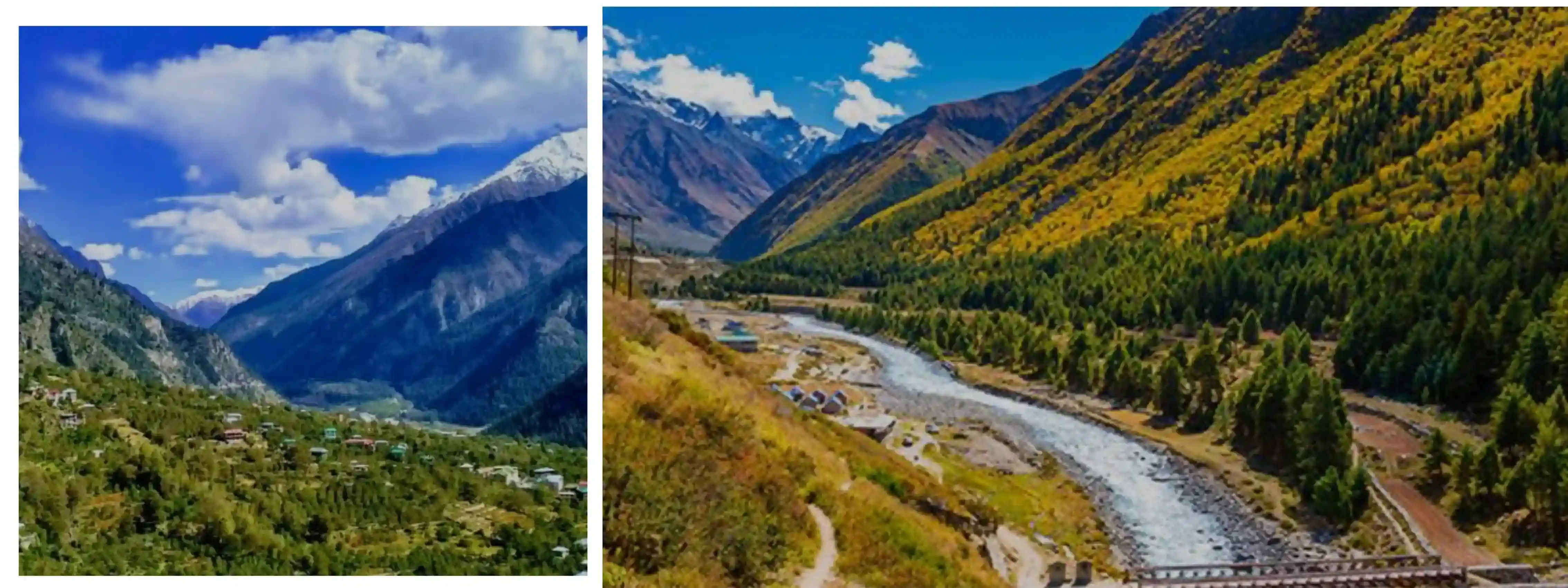
Why This Day Matters
This is where the landscape starts changing dramatically.
You slowly leave behind:
- green valleys,
- forests,
- and riverside villages
and begin entering the rugged Himalayan terrain leading toward Spiti Valley.
Route for Day 3
Sangla → Karcham → Reckong Peo → Kalpa → Pooh → Nako
Road Conditions
Sangla to Reckong Peo
- Mixed road quality
- Some rough mountain stretches
Reckong Peo to Nako
Roads become:
- rocky,
- narrow,
- and more barren.
This section feels much more raw and adventurous.
Stop at Kalpa
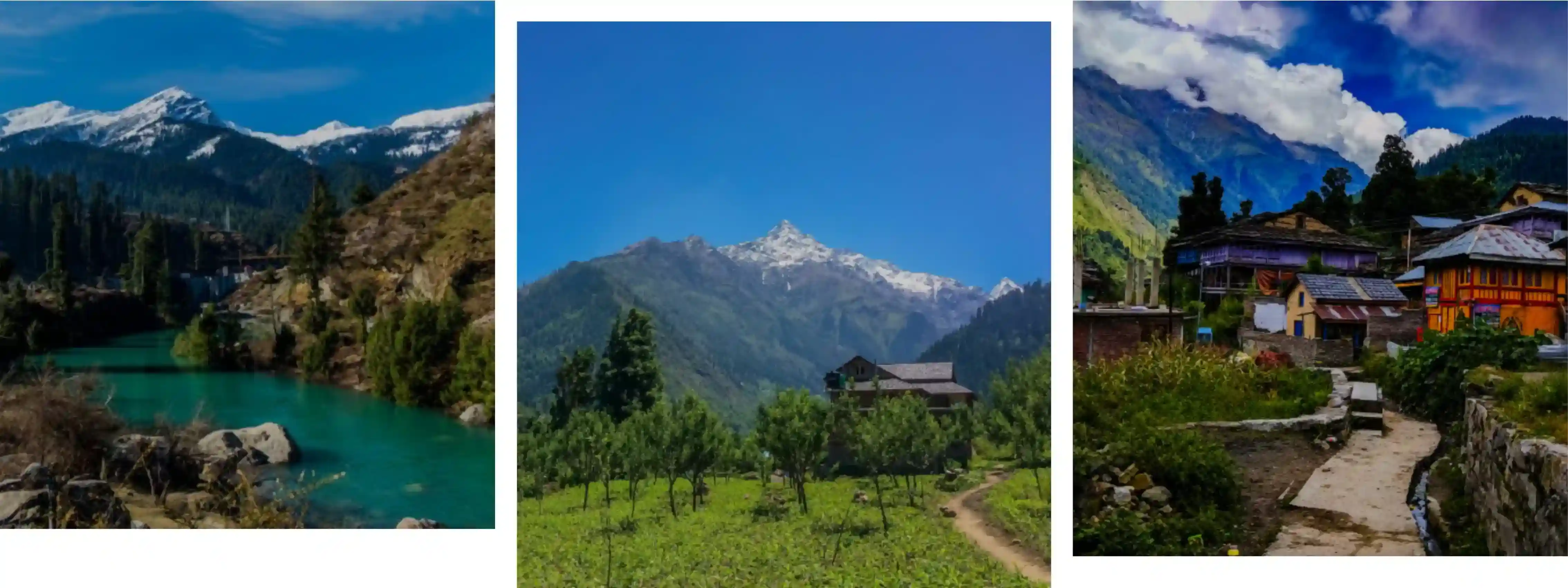
Kalpa is famous for:
- stunning Kinnaur Kailash views,
- monasteries,
- and peaceful mountain stays.
Things to Do in Kalpa
Visit Suicide Point
A dramatic cliffside viewpoint with incredible valley views.
Explore Kalpa Village
Beautiful wooden homes and peaceful local culture.
Sunset Views of Kinnaur Kailash
One of the best mountain sunset spots in Himachal.
Continue Toward Nako
As you move toward Nako:
- greenery decreases,
- roads become rugged,
- and the Spiti landscape slowly begins appearing.
Nako Village Highlights
Nako is a beautiful high-altitude village known for:
- Nako Lake,
- monasteries,
- and peaceful surroundings.
It’s also an excellent acclimatization stop before entering deeper Spiti regions.
Where to Stay?
Option 1: Kalpa
Better hotels and more comfort.
Option 2: Nako
Better acclimatization and closer to Spiti.
Recommended for:
- experienced travelers,
- and tighter itineraries.
Approx Hotel Cost
| Stay Type |
Average Cost |
| Budget stay |
₹1,000–₹2,000 |
| Mid-range hotel |
₹3,000–₹5,000 |
| Premium stay |
₹6,000+ |
Important Tips for Day 3
- ✔ Refuel at Reckong Peo
- ✔ Carry enough cash
- ✔ Roads become rougher after Pooh
- ✔ Stay hydrated for acclimatization
- ✔ Temperatures drop significantly at night
Day 4: Nako to Tabo via Gue Village
Distance
Approximately:
65–90 km
depending on stops and detours.
Driving Time
3–5 hours
This is a shorter driving day, which is good because altitude starts increasing significantly from here onward.
Why This Day Is Important
This is the day you officially enter the core Spiti region.
The landscapes become:
- dramatically barren,
- wider,
- rougher,
- and more surreal.
You’ll begin seeing:
- mud mountains,
- ancient monasteries,
- remote villages,
- and classic cold desert scenery.
Route for Day 4
Nako → Malling Nallah → Sumdo → Gue Village → Tabo
Road Conditions
Nako to Sumdo
- Mixed road quality
- Some rough mountain patches
- Narrow roads near cliffs
Malling Nallah Stretch
This area is known for:
- landslides,
- water flow,
- and broken road sections.
Drive carefully here.
Entering Spiti Valley
Around:
Sumdo Checkpost
you officially enter Spiti Valley.
The landscape changes instantly.
You’ll notice:
- barren mountains,
- minimal vegetation,
- wider valleys,
- and Tibetan-style villages.
Gue Village Detour (Highly Recommended)
Distance from Main Road
Approximately:
8–10 km detour
Why Visit Gue Village?
Gue is famous for:
- the 500-year-old naturally preserved mummy monk.
This is one of the most unique attractions in Himachal Pradesh.
Highlights of Gue Village
Ancient Mummy Monastery
The preserved monk mummy is kept inside a small monastery structure.
The body is believed to have self-mummified centuries ago.
Peaceful Village Views
Gue is tiny, quiet, and surrounded by dramatic mountains.
Perfect for:
- photography,
- short walks,
- and experiencing remote Himalayan life.
Continue to Tabo
After Gue, continue toward:
Tabo
One of the oldest and most culturally important villages in Spiti Valley.
Tabo Monastery
One of the Oldest Buddhist Monasteries in India
Founded in:
996 AD
Tabo Monastery is often called:
“The Ajanta of the Himalayas”
because of its:
- ancient murals,
- mud structures,
- and Buddhist art.
Why Tabo Is Special
Unlike hilltop monasteries, Tabo Monastery sits quietly inside the valley floor.
The atmosphere feels:
- peaceful,
- spiritual,
- and deeply historic.
Things to Do in Tabo
Explore the Monastery Complex
You’ll find:
- meditation halls,
- ancient scriptures,
- old murals,
- and prayer rooms.
Visit Tabo Caves
Small meditation caves located on nearby hills. Short uphill walk required.
Stargazing at Night
Tabo has very little light pollution.
Perfect for:
- astrophotography,
- star trails,
- and Milky Way views.
Acclimatization Tip
Tabo is an excellent overnight stop because:
- altitude gain is gradual,
- and it helps your body adjust before reaching Kaza.
Where to Stay in Tabo
You’ll find:
- monasteries stays,
- homestays,
- hotels,
- and guesthouses.
Approx Stay Cost
| Stay Type |
Average Cost |
| Budget homestay |
₹800–₹1,500 |
| Mid-range hotel |
₹2,000–₹4,000 |
| Premium stay |
₹5,000+ |
Food Availability
Tabo has:
- local cafes,
- dhabas,
- and small restaurants.
Popular food options:
- thukpa,
- Tibetan bread,
- momos,
- maggi,
- rajma rice.
Important Tips for Day 4
- ✔ Drive carefully near Malling Nallah
- ✔ Stay hydrated throughout the day
- ✔ Walk slowly at higher altitude
- ✔ Carry warm layers for evening temperatures
- ✔ Keep enough cash before entering deeper Spiti
Day 5: Tabo to Kaza via Dhankar & Pin Valley
Distance
Approximately:
85–120 km
depending on sightseeing detours.
Driving Time
5–7 hours
including sightseeing stops.
Why This Day Is One of the Best
This stretch includes many of Spiti Valley’s most iconic attractions:
- Dhankar Monastery,
- Pin Valley,
- mud mountain landscapes,
- and finally Kaza, the main town of Spiti.
Route for Day 5
Tabo → Dhankar → Attargo Bridge → Pin Valley → Kaza
Road Conditions
Mostly Good by Spiti Standards
Roads are:
- narrow,
- dusty,
- but generally manageable.
Some rough patches exist near village roads.
Stop 1: Dhankar Monastery
One of the Most Beautiful Monasteries in Spiti
Perched dramatically on a cliff, Dhankar Monastery offers:
- panoramic valley views,
- ancient Buddhist architecture,
- and stunning photo spots.
Why You Shouldn’t Skip Dhankar
The location itself is breathtaking.
You’ll see:
- the Spiti River,
- deep valleys,
- and mud mountains surrounding the monastery.
Optional Trek: Dhankar Lake
Short but Steep Trek
Time Required:
1.5–2 hours round trip
The lake offers:
- peaceful scenery,
- mountain reflections,
- and fewer crowds.
Skip if you’re short on time or not acclimatized properly.
Continue Toward Pin Valley
At:
Attargo Bridge
you can take a detour toward:
Pin Valley National Park
Why Visit Pin Valley?
Pin Valley feels completely different from the rest of Spiti.
Known for:
- greener landscapes,
- traditional villages,
- and peaceful mountain scenery.
Mud Village (Optional Extension)
One of the Most Beautiful Villages in Spiti
If time allows, continue toward:
Mud Village
Highlights:
- glacier views,
- peaceful village atmosphere,
- and riverside landscapes.
Reach Kaza by Evening
Main Town of Spiti Valley
Kaza is:
- the commercial hub of Spiti,
- and the base for most sightseeing.
You’ll find:
- cafes,
- hotels,
- bike repair shops,
- fuel station,
- ATMs,
- and markets here.
Things to Do in Kaza (Evening)
Explore Kaza Market
Buy:
- woolen products,
- souvenirs,
- prayer flags,
- and local handicrafts.
Cafe Hopping
Popular among backpackers and bikers.
Rest & Acclimatize
Kaza sits above:
12,000 ft
Take it easy on the first evening.
Where to Stay in Kaza
Kaza has the widest stay options in Spiti Valley.
Available:
- hostels,
- hotels,
- homestays,
- boutique stays,
- and camps.
Approx Stay Cost
| Stay Type |
Average Cost |
| Hostel bed |
₹500–₹1,000 |
| Budget hotel |
₹1,500–₹3,000 |
| Mid-range hotel |
₹4,000–₹7,000 |
| Premium stay |
₹8,000+ |
Food Availability in Kaza
Kaza has some of the best cafes in Spiti Valley.
Popular dishes:
- momos,
- pizzas,
- Tibetan meals,
- pancakes,
- thukpa,
- and local food.
Important Tips for Day 5
- ✔ Don’t overexert physically in Kaza
- ✔ Walk slowly due to altitude
- ✔ Refuel vehicle in Kaza
- ✔ Withdraw cash if needed
- ✔ Charge power banks and cameras

Day 6: Kaza Local Sightseeing
Why Keep a Separate Kaza Sightseeing Day?
Many travelers underestimate how much there is to explore around Kaza.
The nearby villages and monasteries are among the biggest highlights of the entire Spiti trip.
Keeping one full sightseeing day allows:
- relaxed exploration,
- less driving stress,
- and better acclimatization.
Main Sightseeing Circuit
Kaza → Key Monastery → Kibber → Chicham Bridge → Hikkim → Langza → Komic → Kaza
Stop 1: Key Monastery
Most Famous Monastery in Spiti Valley
Located dramatically on a hilltop, Key Monastery is one of Spiti’s most iconic landmarks.
Highlights:
- ancient Buddhist architecture,
- panoramic valley views,
- prayer halls,
- monk quarters,
- and spiritual atmosphere.
Things to Do at Key Monastery
Attend Morning Prayers
If timing matches, listening to monks chanting is a beautiful experience.
Photography
One of the most photogenic places in Spiti Valley.
Stop 2: Kibber Village
One of the Highest Inhabited Villages in the World
Kibber is known for:
- traditional homes,
- dramatic landscapes,
- and wildlife spotting.
Snow leopards are occasionally spotted in nearby areas during winter.
Stop 3: Chicham Bridge
Asia’s Highest Suspension Bridge
One of the most famous attractions in Spiti Valley.
The bridge connects:
Kibber and Chicham villages
and offers dramatic valley view.
Stop 4: Hikkim
Home to the World’s Highest Post Office
You can send postcards from here.
A popular experience among travelers.
Stop 5: Langza Village
Famous for Giant Buddha Statue
Langza offers:
- fossil-rich landscapes,
- peaceful village views,
- and mountain scenery.
Perfect for photography.
Stop 6: Komic Village
One of the Highest Motorable Villages in the World
Komic feels extremely remote and peaceful.
Highlights:
- ancient monastery,
- dramatic roads,
- and high-altitude landscapes.
Return to Kaza
Spend your evening:
- cafe hopping,
- shopping,
- or simply resting.
Important Tips for Day 6
- ✔ Carry warm clothes even during summer
- ✔ Weather changes quickly at higher villages
- ✔ Keep water and snacks during sightseeing
- ✔ Avoid running or overexertion at altitude
- ✔ Start early for better weather and fewer crowds

Day 7: Kaza to Chandratal Lake via Kunzum Pass
Distance
Approximately:
90–110 km
depending on your campsite location.
Driving Time
5–7 hours
Road conditions become rougher and slower after Losar.
Why This Day Is Special
This is one of the most scenic and adventurous days of the entire Spiti Valley road trip.
You’ll experience:
- rugged mountain roads,
- dramatic landscapes,
- high-altitude passes,
- glacier streams,
- and finally the breathtaking Chandratal Lake.
This stretch truly feels like a Himalayan expedition.
Route for Day 7
Kaza → Losar → Kunzum Pass → Chandratal Diversion → Chandratal Camps
Road Conditions
Kaza to Losar
- Comparatively decent roads
- Smooth by Spiti standards
- Scenic valley views throughout
Losar to Kunzum Pass
Roads become:
- rough,
- rocky,
- dusty,
- and narrower.
Drive slowly and carefully.
Kunzum Pass to Chandratal Diversion
This stretch can be challenging because of:
- uneven roads,
- loose stones,
- and water crossings.
Stop at Losar Village
Last Major Village Before Kunzum Pass
Losar is a peaceful high-altitude village where many travelers stop for:
- tea,
- breakfast,
- and quick rest breaks.
Important Tip
This is a good place to:
- ✔ use washrooms
- ✔ eat properly
- ✔ hydrate
- ✔ check vehicle condition
because facilities become limited afterward.
Kunzum Pass
One of the Highest Motorable Passes in India
Altitude:
Approximately 15,000+ ft
Kunzum Pass is among the biggest highlights of the Spiti circuit.
Why Kunzum Pass Is Famous
You’ll witness:
- snow-capped mountains,
- prayer flags,
- glacier views,
- and dramatic Himalayan landscapes.
The atmosphere feels raw and surreal.
Kunzum Mata Temple
Most travelers stop here to:
- take blessings,
- click photos,
- and enjoy the mountain views.
Local tradition says vehicles should circle the temple once for a safe journey.
Important Altitude Tip
At this height:
- oxygen levels drop significantly,
- and some travelers may feel breathless.
Avoid:
- running,
- overexertion,
- or long physical activity.
Chandratal Lake Diversion
After Kunzum Pass, a narrow road leads toward:
Chandratal Lake
Road to Chandratal
This section is:
- narrow,
- rocky,
- and uneven.
Drive carefully, especially:
- near blind turns,
- and water crossings.

Chandratal Lake
One of the Most Beautiful Lakes in India
Also known as:
“Moon Lake”
Chandratal is famous for:
- crystal-clear blue water,
- mountain reflections,
- and dramatic landscapes.
The lake changes color throughout the day depending on sunlight.
Short Trek to the Lake
Vehicles cannot go directly to the lake.
You’ll need to walk:
around 1–2 km
from the parking area.
The walk is relatively easy but can feel tiring because of the altitude.
Best Things to Do at Chandratal
Photography
One of the most photogenic locations in Himachal Pradesh.
Stargazing
Chandratal is famous for:
- clear night skies,
- Milky Way visibility,
- and astrophotography.
Because there is almost no light pollution, the stars look incredible here.
Camping Experience
Camping near Chandratal is one of the most memorable parts of the trip.
Chandratal Camps
You’ll find:
- Swiss camps,
- luxury camps,
- and basic tent stays.
Camping areas are located slightly away from the lake for environmental protection.
Approx Camp Cost
| Stay Type |
Average Cost |
| Basic camps |
₹1,500–₹2,500 |
| Standard Swiss camps |
₹3,000–₹5,000 |
| Premium camps |
₹6,000+ |
Most camps include:
- dinner,
- breakfast,
- and basic bedding.
Weather at Chandratal
Even during summer:
nights become extremely cold.
Temperatures can drop near:
0°C to 5°C
Carry:
- heavy jackets,
- thermals,
- gloves,
- and warm socks.
Food Availability
Food options are limited near Chandratal.
Most travelers eat at:
- campsites,
- small dhabas,
- or temporary food stalls.
Keep:
- snacks,
- chocolates,
- and water bottles
with you.
Important Tips for Day 7
- ✔ Leave Kaza early in the morning
- ✔ Drive slowly after Losar
- ✔ Carry warm clothing easily accessible
- ✔ Avoid overexertion at Kunzum Pass
- ✔ Keep power banks charged
- ✔ Network connectivity is extremely limited

Day 8: Chandratal to Manali to Chandigarh
Distance
Chandratal to Manali:
Approximately 130–140 km
Manali to Chandigarh:
Approximately 300 km
Driving Time
| Stretch |
Approx Time |
| Chandratal to Manali |
6–8 hours |
| Manali to Chandigarh |
7–9 hours |
Why This Day Is Challenging
This is usually the longest and most tiring driving day of the trip.
You’ll encounter:
- rough roads,
- water crossings,
- traffic near Manali,
- and long highway driving afterward.
Many travelers prefer staying overnight in:
Manali
instead of directly returning to Chandigarh.
Route for Day 8
Chandratal → Batal → Gramphoo → Atal Tunnel → Manali → Chandigarh
Road Conditions
Chandratal to Batal
Very rough and rocky roads.
Drive extremely carefully.
Batal to Gramphoo
One of the toughest stretches of the trip.
Expect:
- water crossings,
- broken roads,
- mud,
- and off-road terrain.
Important Tip
Cross water streams:
early in the morning
because water flow increases later in the day due to glacier melting.
Stop at Chacha Chachi Dhaba (Batal)
A legendary stop among bikers and Spiti travelers.
Known for:
- hot tea,
- maggi,
- rajma rice,
- and warm hospitality.
Entering the Manali Region
After:
Gramphoo
road conditions improve gradually.
The landscape changes again:
- greener valleys,
- forests,
- waterfalls,
- and increased tourist activity.
Atal Tunnel
One of the biggest engineering landmarks in Himachal Pradesh.
The tunnel significantly reduces:
- travel time,
- and difficult mountain driving near Rohtang Pass.
Reach Manali
Most travelers:
- rest,
- eat properly,
- refuel,
- and take a short break here.
Optional Stay in Manali
Highly recommended if:
- traveling with family,
- tired from driving,
- or not comfortable with long highway drives.
Continue Toward Chandigarh
After Manali:
roads improve significantly,
and highway driving becomes easier.
However:
- traffic near Kullu and Mandi can increase travel time.
Approx Fuel Cost for Full Circuit
| Vehicle Type |
Approx Fuel Budget |
| Hatchback |
₹8,000–₹12,000 |
| SUV |
₹12,000–₹18,000 |
| Bike |
₹4,000–₹7,000 |
Depends on:
- mileage,
- route diversions,
- and driving style.
Total Approx Budget for 8-Day Spiti Trip
| Travel Style |
Approx Budget Per Person |
| Budget trip |
₹12,000–₹18,000 |
| Mid-range trip |
₹20,000–₹35,000 |
| Premium trip |
₹40,000+ |
What This 8-Day Itinerary Covers
- ✔ Shimla route acclimatization
- ✔ Kinnaur Valley
- ✔ Chitkul
- ✔ Kalpa
- ✔ Nako
- ✔ Tabo Monastery
- ✔ Dhankar Monastery
- ✔ Pin Valley
- ✔ Kaza sightseeing
- ✔ Key Monastery
- ✔ Hikkim
- ✔ Langza
- ✔ Komic
- ✔ Kunzum Pass
- ✔ Chandratal Lake
- ✔ Manali return circuit

Final Itinerary Tips
Don’t Rush the Journey
Spiti is about:
- landscapes,
- experiences,
- and slow travel.
Keep Buffer Time
Roadblocks and weather delays are common.
Respect Mountain Conditions
Drive responsibly and avoid risky overtaking.
Stay Hydrated Throughout the Trip
Altitude dehydration happens quickly.